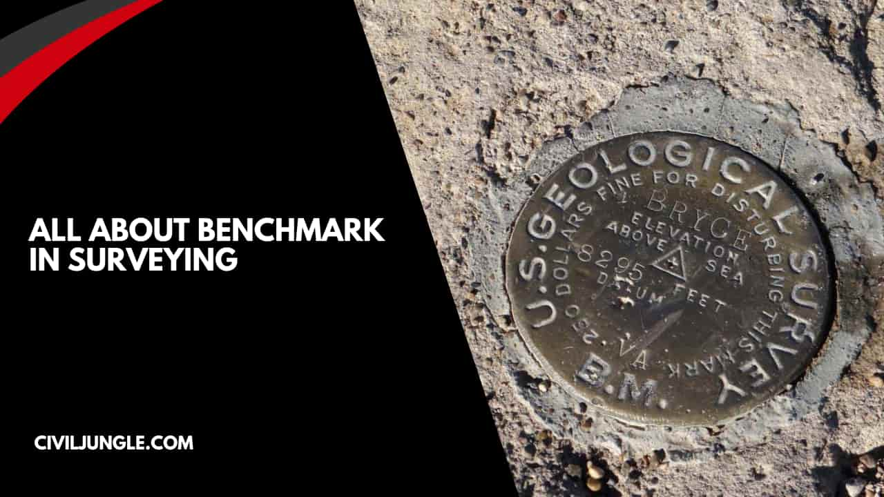
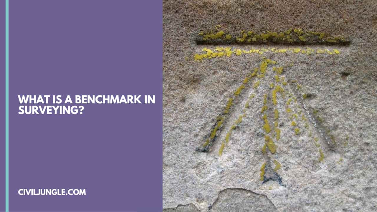
What is a Benchmark in Surveying?
Important Point
Benchmark is a permanent and temporary reference point in surveying. The term is usually applied to any item used to mark a point as an elevation reference.
Type of Benchmark in Surveying
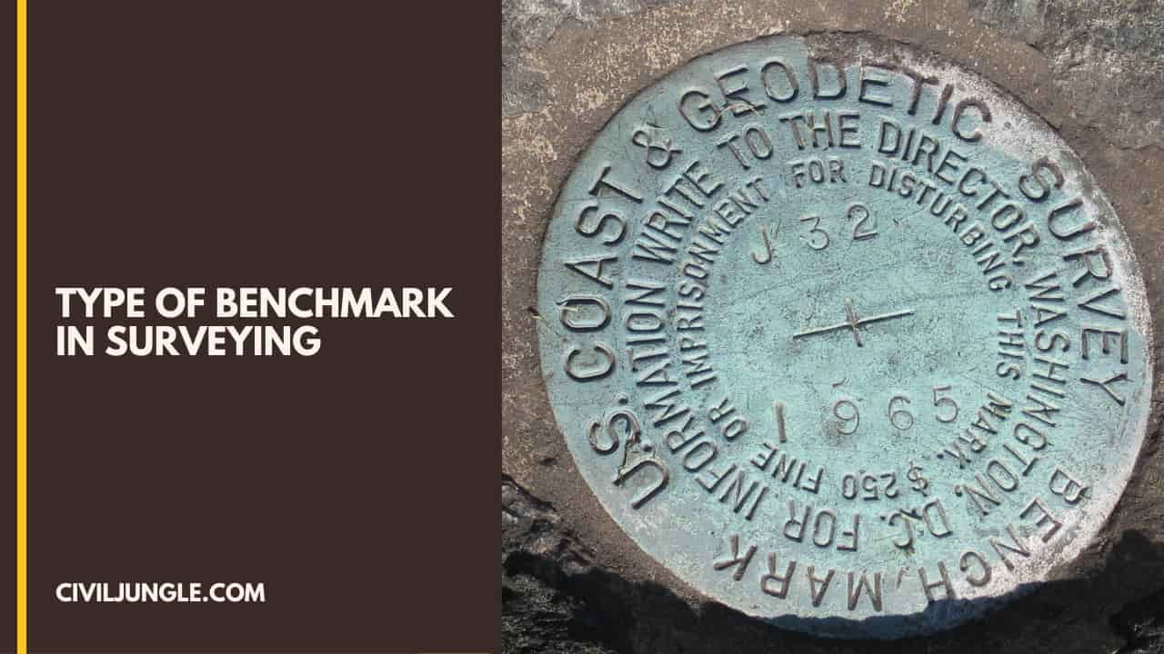
It is a relatively permanent point of reference whose elevation for some assumed datum is known. It is a starting and ending point in levelling. The following four types of bench-marks are commonly used
- GTS Benchmark in Surveying
- Permanent Benchmark in Surveying
- Arbitrary Benchmark in Surveying
- TBM in Surveying (Temporary Bench Mark)
Also, read: What is Consistency of Cement
GTS Benchmark in Surveying
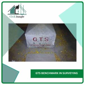
A GTS Benchmark full name Great Trigonometrical Survey. GTS is permanently fixed reference survey station, having known elevation related to respect related (MSL = Mean Sea Level). All these are established all over India by a survey of India department with greater precision.
A benchmark value is quite essential in any survey area, especially for the reduction of sea level concerning mean sea level or CD (CD = Chart Datum).
While carrying out a bathymetric survey of a survey area, the datum referenced values so obtained are utilized to compute the final depth contours of this survey area for CD.
Thus, a benchmark, having known elevation, is quite essential in the survey area; without that, preparation of a bathymetric chart is impossible.
In some places, GTS benchmarks are available within a kilometer distance and can be easily moved to the survey area by fly leveling using an automatic Level instrument along with a graduated leveling staff.
However, in the majority of the cases, GTS benchmarks might be at much away distance in the area to be surveyed. In such cases, the most common traditional way of transferring the benchmark value using an automatic level instrument is a difficult job; consuming an enormous amount of time and labor.
To eliminate this process, a method is suggested in this technical report to move the GTS benchmark from any distance to the survey area. The latest Digital Total Station (ETS) is a tool which may be used for this purpose.
The main advantage of applying this method is a considerable amount of time could be saved while maintaining the required accuracy.
The long-form of the GTS benchmark is the great Trigonometric Survey benchmark. They’re established by national agencies like a survey of India. They’re established with the highest accuracy at several locations all around the country, depending on the mean sea level.
The survey of India has used a mean sea level of Karachi (Pakistan) as a datum. All these benchmarks are indicated on a brass plate fixed to a concrete pedestal with well-protected wall.
The U.K. Ordnance Survey and the U.S. Geological Survey have established similar, standard benchmarks in their countries. These benchmarks are used as reference or starting points for all important surveying work.
As Per Below list agencies for different countries.
- India = Survey of India
- United Kindom = Ordnance Survey
- Pakistan = Survey of Pakistan
- New Zealand = Land Information New Zealand
- Canada = Natural Resources Canada
- Japan = Geographical Survey institute
- United States = The United States Geological Survey
- France = Institut Géographique National
- Republic of Ireland = Ordnance Survey Ireland
- Italy = Istituto Geografico Militare
- South Africa = Department of Rural Development and Land Reform
- Spain = Instituto Geográfico Nacional (IGN)
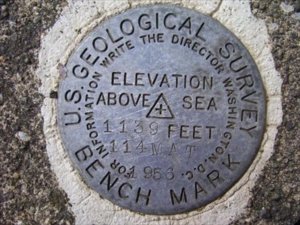
GTS Benchmark in US
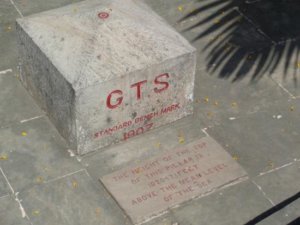
GTS Benchmark in India

GTS Benchmark in United Kindom
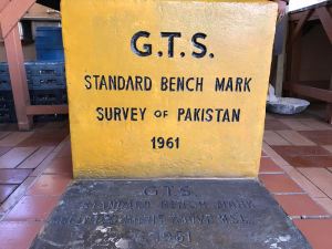
GTS Benchmark in Pakistan
Also, read: What Is Soundness of Cement Test
Permanent Benchmark in Surveying

Permanent benchmarks are fixed reference points established by government agencies like the erstwhile Public Works Departments in certain states, starting from the standard benchmarks such as GTS.
Conspicuous points onto culverts. Bridges and buildings are normally chosen. The exact position of the benchmark might be marked with a small rectangle or arrow, as shown in Fig. No. A bronze tablet might also be utilized.
Permanent Benchmark setup by state Government agencies like the Public Work Department (PWD) fix such a benchmark.
Also, read: What Is the Penetration Test | What Is the SPT Test | Procedure | Efficiency | Advantages and Disadvantages
Arbitrary Benchmark in Surveying
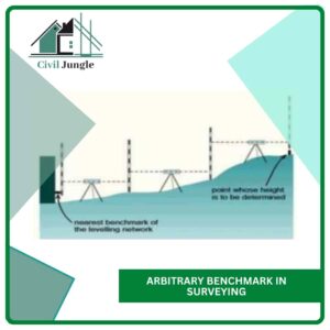
Arbitrary Benchmarks In most engineering projects, the difference in elevation is much more important compared to a reduced level when it comes to mean sea level.
In these cases, the elevation of a permanent structure such as a corner of the plinth of a building might be assumed to have an arbitrary reduced level, like 100.00 m or 500.00 m. All these benchmarks are quite useful in small projects.
Also, read: What Is Raft Foundation | Type of Footing | Detail of Raft Footing
TBM in Surveying (Temporary Bench Mark)
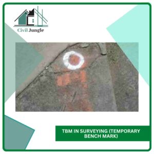
This type of benchmark (TBM) is established at the end of the day work,
Next day work might be continued from there.
Such point ought to be to a permanent object to ensure next day It’s easily identified.
Also Read: Levelling in Surveying
Benchmark in Surveying
A benchmark is a point of reference by which something can be measured. In surveying, a “bench mark” (two words) is a post or other permanent mark established at a known elevation that is used as the basis for measuring the elevation of other topographical points.
Permanent Bench Mark
In surveying, a “bench mark” (two words) is a post or other permanent mark established at a known elevation that is used as the basis for measuring the elevation of other topographical points. The total context against which all products are measured and compared is referred to as the benchmark.
Types of Benchmark in Surveying
Benchmark
- Great Trigonometrical Survey benchmarks.
- Permanent benchmarks.
- Temporary benchmarks.
- Arbitrary benchmarks.
Gts Benchmark
A G.T.S. (Great Trigonometrical Survey) benchmark is a permanently fixed reference survey station (or point), having known elevation with respect to a standard datum (mean sea level). These are established all over India by Survey of India department with greater precision.
What Is Benchmark in Surveying?
In surveying, a benchmark refers to a point of reference that is used to establish the elevation or height of other points in the surveyed area. It serves as a fixed and stable point with a known elevation that can be used as a basis for measuring and comparing the elevations of other points in the vicinity.
Tbm in Survey
A temporary benchmark (TBM) is a fixed point with a known elevation used for level control during drainage construction works of houses and surveys. Nails on road level or marks on drainage channels are commonly used as temporary benchmarks.
What Is Bench Mark in Survey?
In the context of surveys, a benchmark refers to a standard or reference point against which survey results can be compared. Benchmarks are used to assess the performance or characteristics of a particular group or entity in relation to others.
What Is Tbm in Surveying?
temporary benchmark (TBM)
A horizontal platform that is established to provide a known reference point with a set level. Once the level is established, the temporary reference point can be used to check and fix other levels around the site.
How to Set a Benchmark in Surveying?
- Define survey objectives and desired metrics.
- Gather relevant data from previous surveys or external sources.
- Analyze the data to understand current performance levels.
- Identify high-performing entities as aspirational benchmarks.
- Establish benchmarks for each metric or KPI.
- Communicate benchmarks to stakeholders.
- Monitor and update benchmarks periodically.
Bm in Surveying
In the context of surveying, “Bm” typically stands for “Bench Mark.” A Bench Mark is a fixed reference point on the Earth’s surface with a known elevation. It serves as a benchmark for measuring heights or elevations of other points in a survey.
Tbm Meaning Surveying
In surveying, “TBM” stands for “Temporary Bench Mark.” A Temporary Bench Mark is a reference point established by surveyors for a specific project or survey. Unlike permanent Bench Marks that are intended for long-term use, Temporary Bench Marks are typically set up and used temporarily during the duration of a particular survey or construction project.
Types of Bench Mark in Survey
Types of Bench Mark
- GTS benchmark.
- Permanent benchmark.
- Arbitrary benchmark.
- Temporary benchmark.
What Is Benchmark in Geography?
In geography, a benchmark refers to a specific type of reference point used to determine the elevation or height of a particular location on the Earth’s surface. Benchmarks are used to establish a consistent and standardized elevation reference system.
What Is Benchmark in Civil Engineering?
A benchmark is a pre-determined standard or point of reference against which other things, people, costs, time or activities can be measured. It is regarded as an achievable standard which a failure to achieve could deem the work in question to be unsatisfactory.
Like this post? Share it with your friends!
Suggested Read –
- First Angle Projection & Third Angle Projection Symbol (Orthographic Projection)
- Introduction of Gantry Girder | Load on Gantry Gutter | Types of Load on Gantry Gutter
- What Is Dry Pack Mortar | Advantages of Dry Pack Mortar | Disadvantages of Dry Pack Mortar
- What Is Unit Weight | What Is Density | What Is Unit Weight Material | Unit Weight Building Materials
- What Is Pier Foundation | Types of Drilled Piers | Advantages and Disadvantages of Drilled Pier Foundations
- What Is Diversion of Headworks (Rivers) | Types of Diversion Headworks | Component Parts of Diversion Headworks (Rivers)

Leave a Reply